Wednesday, October 22, 2008
Tuesday, October 21, 2008
Monday, October 13, 2008
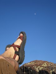
Lake Powell - August 2008.
The Bullfrog put-in @ Lake Powell is a busy place with its own lengthy boat ramp, neighboring campgrounds, gurgling semi-truck trailers, and tired families with gas cans and dogs in tow. We rolled up to the scene as a small cluster of vehicle and kayaks, trying to thread ourselves between the lumbering mammoth houseboats fumbling along the dock. Within an hour's preparation, we were off and away. Soon, we were quietly leaving behind the murmuring cacophony as we leaned forward toward the unknown one slip of the paddle at a time.
Push, Rotate, Draw, Heave, Fore, Aft... "Use your core, not your arms." I struggled to rekindle my muscle's memory of sea kayaking excursions long gone by. Struggle as I might though, I could do nothing to shake off the nervousness and pestering self doubt growing in my head.
Will I stand up to the physical rigor. Did I bring enough food. Will I capsize. Will I damage something. Will we get swamped by a swift desert storm. Will either one of us be destroyed by any one of these giant floating frat parties. Can I really survive this. Breathe, Pull, Lean, Breathe, Pull again and again. Constant.
As the sun rolled through the sky, the nerves and self doubt began to slowly abate as they were washed against the staggering enormity of the red rock country. A deepening appreciation of the world and events unfolding around me gathered as we continued farther along these hallowed halls. Sculpted and shaved cliff walls looked over our journey as they held back the blackish water's constant languid pressure.
We founded the first camp upon the lightly lapping shores of a slickrock lined inlet. After pulling the boats ashore we began what would soon become routine, the construction of a temporary but comfortable place to rest. Food was prepared and both sails and weary muscles were unfurled and allowed to dry. Dinner was ate and bedrolls were laid out underneath an intensifying canopy of diamonds affixed against the blackest of interstellar space. The Milky Way's cloudy edge shone across the heavens, strapping all of humanity in for the ride.
As I became accustomed to the common occurrences of a life spent paddling, the events of each day's passing began to stream together. From a rare but curious California condor who insisted on investigating our small flotilla over and over - pass after circling pass until the heated air currents lifted his massive wingspan well above our gazing eyes. We were to be met by this same gentle giant 3 times in as many days and each time it stilled the air around us. We watched as he watched.
Whenever we could, we would festoon our sturdy boats against the sides of the floating pooh palace. This shining beacon of bowel loosening hope. These fastened and buoyed restrooms were occasionally strewn about the lake... and to find one meant not carrying your own excrement later on should you give way to the forces of nature while back at camp. We would hang along the decks of these establishments for as long as it took until the big event finally arrived before resuming the day's travels.
Sunsets and sunrises soon became our only time keepers. We watched their slight changes over the evenings and following mornings. Subtle progressions made themselves known to only those who cared enough to pay close attention. The heavens retold their haunting yet familiar story out each night, but with small declinations of difference. And the moon slowly regressed its brightly lit hue waxing itself away while rising later each night. The entire orchestra of the natural world revealed it's synchronized splendor before our humbled eyes. We quietly took careful notice.
The end of our trip would come too quickly. Soon enough we were within a distant visual of the chaotic shores of the Bullfrog boat ramp. Burgers and beers were not far off, and we gravitated toward our eventual reward. During the last few miles, the afternoon's piercing heat laid waste to my beleaguered shoulders and arms making the last stretch drag on for what felt like days. Breathe, Pain, Rotate, Draw, Breathe... "Use your core, not your arms." I mindfully returned to the basics until we finally washed ashore one last time. The sun continued to chastise our already tanned hides as we retrieved our vehicle, inspected the gear, packed our belongings, took one last seaside poop, and stumbled off into the parched desert highlands bound for Moab and the plunder therein.
Thoughts: Thinking:
Monday, June 02, 2008


Monday, April 21, 2008
Earth Day, 2008 is upon us...
http://en.wikipedia.org/wiki/Earth_Day
Note that the "...neutrality of this article is disputed" but generally speaking it marks the anniversary of the birth of the modern environmental movement in 1970. Interestingly enough, not all greenies enjoy the 'holiday.' Some... "Bright Greens" (http://en.wikipedia.org/wiki/Bright_green_environmentalism) apparantly think it's a bit too watered down. What i find fascinating is how there is apparantly several shades to being green! At any rate, hug a tree tomorrow and take a moment to enjoy the sun eh.
Tuesday, April 15, 2008

We're in Bat Country!
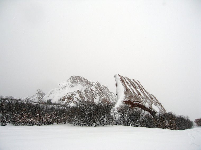
 The Picture of the (interval) this time comes to us from Moab, UT on the SlickRock practice loop. This shot overlooks the small but dramatic Echo Canyon.
Sunday, April 06, 2008
The Eve of Destruction
Thus far, our plan consists of a ride on Mary's Loop outside of beautiful Fruita, CO on Friday and a suitable Moabbian ride on Saturday. If you've a suggestion, please leave a note below. Sunday will be Over the Edge perhaps...
Stay tuned as we chronicle these further misadventures...
Monday, February 18, 2008
Movie Feature: Robert Redford on the Red Rock Wilderness Act
The movie is part reverence for the desert lands of Utah, and part advertisement for the Red Rock Wilderness Act. The proposed act would preserve more than 9.5 million acres of already wilderness-quality BLM lands inside Utah... probably not a bad idea. I rarely espouse on political issues on this blog but this one is near and dear to the heart so I thought i'd say a few things...
While I believe wilderness is essential to America in numerous ways, I have a love/hate relationship with it. I, like many, value wild lands and am continualy thank full for their existance, but I do wish they were open to mountain bikes. I know, I know, controversial for sure but allow me just a few moments to opine... I concede that opening the wild lands to mtb'ers would surely bring about change to "wilderness." However, this change is perhaps nothing more than a nod to humanity's current state of affairs. Fewer and fewer people care for and ride horses in the 21st century (more on this...) while more and more people still desire the experience of wilderness. MTB's are just the latest tool of transportation that could so easily enable the people of America... the world really... to continue to expereince these national treasures. Additionally, as we carry on into this "century of scarcity" the wild lands and the people who protect them will need to build ally's with a greater audience of enthusiastes who will stand beside them in support when times and politics are tough for these sacred places. The Wilderness Society and Sierra Club members need IMBA members just as much as the reverse. Only through cooperation and focus can the currently divided interests unite and create a better chance at saving these places together. So, overall, I do support this initiative, but I also think its time to update our access to the lands we're all trying to protect...
K, thanks for reading as always!
Picture of the (Interval)
 This (interval)'s picture was taken during my last trip to Loveland Ski Area. Which incidentally was recently awarded best local's (Denver, CO locals I imagine) ski area (and no I can't remember my source...bad!) The pic was shot while traveling westbound up chair #2 which for those of you who aren't familiar, traverses over southbound lift chair #6. I always look forward to the brief moment the two suspended paths silently cross and I am afforded a rarely privileged view of brother and sister snow riders from above.
 Enjoi and have a great... (interval).
Thursday, February 14, 2008
Kind Powder Interlude: Loveland's Federal Reserve!
 Since the title of this blog is afterall "Kind Powder" and given that I am well past due with the 3rd post in the Colorado Trails website review, I thought it was high time for a powdery interlude! This pic was taken just days ago up on the Continental Divide up somewhere near 13,000' elevation and behind Lift 8. I believe the run is adjacent to the "Federal Reserve" runs. The snow was truly steep and deep and was WELL worth the 45 minute access hike.
 Tuesday, January 29, 2008
Website Reviews: Trail Data Websites, Part 2.
Kevin Swab, the webmaster of CoMTB, advertises that the site provides mountain bike ride descriptions with high quality maps suitable for navigational use. It's Kevin's navigational maps that makes CoMTB so uniquly valuable. By comparison, most any other site usually misses this mark providing its unwary users with poor quality maps that come with a disclaimer warning against the use of their maps for anything other than birthday hats for kids.
This site's visual focus is centered around the map of Colorado. Within that map are several clickable icons depicting various city centers that have trails of interest nearby. For instance, when you click on the Lyons icon, you are treated to trail beta for the following trails:
- Betasso Link / Loop
- Fall River Road
- Hall Ranch
- Heil Valley Ranch
- Miller Rock Area

This graphic is an example of one of those previously mentioned high quality printable maps. They are without a doubt credible works of art of their own and should be printed, framed and proudly displayed in every Colorado rider's home.
As a devotee of the site for several years, I became worried of its sudden lack of updates after the mid 2006 model year. Some 15 months would go by before we would see the next major update. But news of the websites early demise were greatly exaggerated and updates to the UI and content come with regularity again. Most recently, the site has began Google Earth integration on many of its rides.
Each trail review featured on the site typically includes a blow by blow ride experience complete with related pictures. In addition to the beta are Google Earth'd trail downloads (when available), accompanying recommended Google Earth viewing settings, and downloads to those wonderful maps.
CoMTB's author is based out of beautiful Ft. Collins, CO and admittedly focuses on north central CO rides. To compensate for this, the site relies upon other MTB friendly sites that happen to highlight trails in other regions. For example, CoMTB has reviews for 11 different towns (with several trails per town), but provides useful links to content on other sites for an additional 23 towns within the state. This method is in contast to TrailCentral's user generated content model with the difference being noticible in the total amount of data available per trail and in the total number of trials reviewed on the site. But this could change with time as I eagerly await each new review and related map... mmmmmm like butter.
In all, CoMTB goes the extra mile at providing reliable trail ready maps with relavant information for when you are planning your trail ride. Two thumbs up again for CoMTB.
I'll dive into the next trail review website in the series soon so stay tuned. Until then, best of riding.
Sunday, January 27, 2008
Return of: Picture of the Week(?) - January, 2008
 I'm unsure of just how many Picture of the Week's I'll be posting in the coming weeks, so instead I'll be renaming this somewhat regular feature to... "Picture of the Interval, where Interval is x number of n units of time." Maybe a better name is "Picture of the x=(n)/T." I think that is right... anyway, this picture was taken at Garden Of the Gods near Colorado Springs, CO. The picture depicts 2 of the park's Three Graces.
 Garden of the Gods contains vertical conglomerate sandstone formations belonging geologically to the Fountain Formation. The Fountain Formation is related to the Red Rocks, Roxborough, and Flatirons areas west of Denver, CO. The entire formation begins in southern Wyoming and continues south along the Front Range of the eastern Colorado Rocky Mountains, concluding in northern New Mexico. The name Colorado is said to come from the color of this particular sandstone formation. The rocks comprising the Fountain Formation are considered to be between 290 and 296 million years old and were formed by the erosion of the original Ancestral Rocky Mountains.
Sunday, January 20, 2008
Website Reviews: Trail Data Websites, Part 1.
Luckily, the intraweb has come to our rescue. With a quick Google search, I was able to track down the leading contendors: TrailCentral, COMtb, MTBR, singletracks.com, Wildernet, and BikeRag.com. (If your favorite trail review website isn't listed, post a comment below and I'll be sure to check into them).
Each one of the the website ablove tackles the complex task of mapping, reviewing, and posting useful information about the Colorado's trails in different ways. Some sites excel at trail beta, others include printable maps, others feature GPS integration, and yet others are gifted with prolific user reviews... Some do it all... Anyway, on with the show.
1. TrailCentral.com:
According to TrailCentral author, it took 3 college students eating a "rather disgusting" pizza in 1999 to create their very own Mountain Biking website. It took several iterations for them to nail down their presence on the web, but when they did the site took off. TrailCentral.com's mission is to enable its users to "...be able to find complete trail information on Colorado trails, such as; trail listings and directions, trailhead weather, local bike shops, as well as complete event listings." Or more simply put, to "...help mountain bikers look beyond the handlebars." It is a lot for a single site to offer, lets take a look and see how they fare...
Since their original inception, TrailCentral's scope has grown to include trails in other states, bike shop reviews, and more. The site breaks their trail reviews out first by state name and then by county. The state is listed only if there is a trail review in it. Likewise, the county is only listed if there are trail reviews in it. So, if you don't see your favorite trail on the map, you know what to do... Click on any county within TrailCentral and you will find a more detailed map of the area and a listing of trails in that county. click on any trail theirin and you get the following laundry list of useful trail specifics:
- Local bike shops
- Integrated hotel booking
- Summer trail uses
- Winter trail uses
- Trail types
- Physical exertion level
- Technical Level (which evaluates the difficulty of the terrain)
- Elevation at the trailhead
- Park fees if applicable
- Park facilities available
- Directions to the trailhead
- GPS datum marking the trailhead and route (if it has been gathered by a trail reviewer)
- Current trailhead weather
- A description of the trail itself
- A RSS integrated "Ride Proposal" arranger
- Overall Trail Ratings
- and finally, Trail reviews written by users like you and I
It's a tough job filling in all those blanks for each and every trail the website reviews which is why the site relies on their user community to pitch in. It's this "user generated content" that helps to fan the flames at TrailCentral, adding useful content to nearly every part of their site. The site's crew has taken the trail review concept to even greater levels by adding a 3rd layer to the cake when they added the ability for website visitors to participate in their online forum, to post their blog (if they have one), to find training partners, and to post their own pics in the photo
TrailCentral is also kept up to date on a very regular basis. The websites development is ongoing, with new improvements made ever week at times. About a year ago, they integrated their original trail maps with the Google Maps api. This fantastic improvement allowed the site to later many features including trailhead markers, zooming in and out, route finding, and the integration of GPS data (and not just their own GPS data, but anyone's). TC also claims that 2008 will continue to be a big year for the website with usability enhancements that will dip into the power of AJAX (yay!).
In all, TrailCentral goes a long way to being a great one stop shop for gathering information for your trail riding plans. Two thumbs up.
Next up is the second website review in this series. Until then, best of riding!
Tuesday, January 15, 2008
Dispiriting news for our mountaineering community...


Colorado Cycling in 2008
Kicking off the New Year...
http://s119.photobucket.com/albums/o149/mag77gie/?action=view¤t=wtihkvideo.flv