Begun in 1879 by the Northern Colorado Irrigation Company, The Highline Canal is 74 miles long, an average of thirty feet wide, originally cost $650,000 and took four long years to complete. It was designed to carry nearly three-quarters of a billion gallons of water per day, but averages only one-tenth of that now with 71 million gallons. British investors supplied the capital for the project which proposed to place a million acres of land under cultivation. However, they had difficulty securing sufficient water for the canal because earlier ditches held irrigation rights based on prior claims (thanks to Colorado's crazy water law). The seventy-four mile length of the canal drops at a super sweet uniform rate of thirty-two inches per mile making it utterly and completely flat.
While the Highline is a multiuse trail, with people using it for horseback riding, biking, walking, jogging and so on, I personally use it for canine energy release. I take the quick drive out to Titan road via US285 south of Denver and access trailheads from there. The stretch of the Highline as it exits Waterton Canyon until it reaches Highlands Ranch is fairly Nirvana inducing with its quiet and sublime lengths. If you follow it long enough, you eventually cross paths with a family owned and operated horse boarding facility that just happens to provide a prodigious amount of shade, tree ladders and rope swings - some of which are designed to propel the swinger into the Highline for a good swim. Further west you stroll past eclectic neighborhoods of geodesic and coonial homes and soon thereafter the trail enters cattle ranchland. Depending on the time of year you take to the trail, you just might find yourself "sharing the road" with the big, beautiful and bovine.
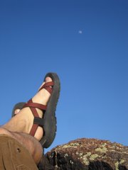
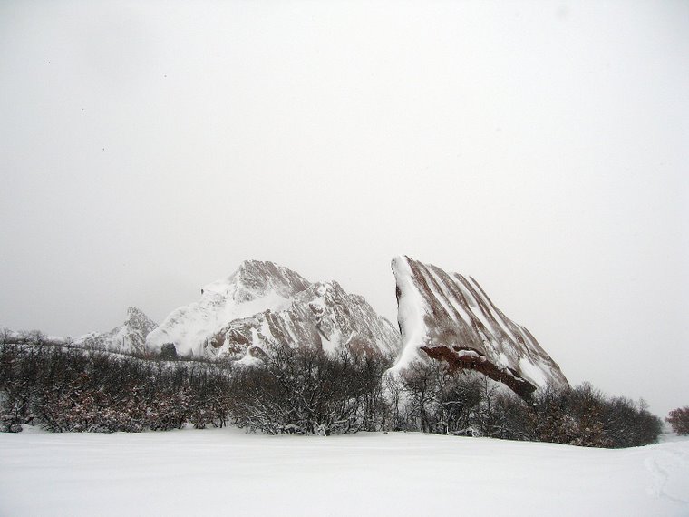
Water typically runs in the canal during the spring months of April and May and ceases in the summer swelter when you'd figure you would want it most. Bring a camera as views of the Front Range from the trail are picture worthy. Take a look below for a couple of good pics taken earlier this month.
So lets say you are crazy about biking. And, just for the sheer joy you decide to ride the Colorado Trail. If you were so inclined, this means you could start your ride from all the way back at the Rocky Mountain Arsenal effectively adding some 70 extra miles to the ride as you meandered in and around Aurora, Denver, Littleton, Glenwood and so on. Anyone game? ;)
Saturday, July 21, 2007
Friday, July 20, 2007
The Month in Pictures: July:
 Along the Highline Canal: east of Waterton Canyon.
 Along the Highline looking west towards Roxborough.
Sunday, July 08, 2007
Ride Report: Buffalo Creek Trail Complex... EPIC!

If you are a regular reader of this humble Blog... you may recall the interview I held with the C:\EO of Sopris Clothing, Curtis Lewis. In it, he mentions what H3ll Hath Wrought on his poor soul during an arduous ride he had with our good friend Bill. You see, Bill is a hekka good rider and a seasoned athlete. Bill also manages to click off 3 rides each week including a 50 miler on the pavement every Sunday morning (that rat bahstad!). On that particular ride with Curtis at Buffalo Creek, they endeavored to link together several trails to complete a 24 mile loop. For whatever reasons... and I'll leave the details to those two to sort out, Curtis came back from it claiming a unprecedented ass-kicking. Given this tantalizing story, I was immediately intrigued...
So 3 weeks later, Bill and I loaded up the truck and set out for a repeat of this infamous 24 mile loop. We parked in front of the Buffalo Creek Volunteer Fire Station and unloaded our gear there. Excited for the epic that lie directly ahead, I followed Curtis' advise and stuffed my Camelback with extra provisions of food and water.
We started with a 3 mile warmup along the roadside gaining about 800 feet in elevation. Just after the crest (read as the 4th false summit) on the right we departed the highway's pavement and hit the dirt. Soon thereafter we joined the renowned Colorado Trail where the dance truly began. Immediately we began to weave our bikes deep into the Pike National Forest's earthen fabric; our knobby tyres carefully interlacing with gravel and pine needles. A days rhyhem was beginning to form...
The Pike National Forest is near uniformly graced by pegmatite gravelly soil, coloring the earth beneath your bike an orange-pink. Overall, the trail slopes gently away enough to relieve neary any need to pedal. At the Tramway trail junction, we bid the CT farewell and continued the downhill dream to 543 Road Trail where we hung a sharp left for a quick doubletrack climb. Following this past an incredible mountain cabin and ranch, we joined Buffalo Creek Road and took a right. We used the dirt road for just long enough to reach the trailhead for Gashouse Gulch which became the restart for the long, slow climb back up to elevation. Gashouse is far from a technical climb nor is it as steeply inclined as a typical front range ride, but still packs a punch.
Gashouse intersects with Charlie's Cutoff, and if you make the drive to Buffalo Creek for anything, make sure you yummy down on Charlie's Cutoff as it is easily one of Colorado's premier rollercoaster rides and something you'll never forget. Charlie's ends all to soon and joins the Homestead trail which is another swoopy stretch of earthly ribbon sure to leave you grinning unexpectedly as you pedal along its pink gravely shores. Homestead then joins Sandy Wash which means we were nearing completion of our 24 mile ride. Sandy Wash will leave an indelible image in your mind while riding its chutes and ladders up around grassy fields where the ponderosa pines grew before the Hayman fire. Its on this section of trail that I felt the unique sensation that I can only describe as bicycle dancing. Charlie's Cutoff, Homestead, and Sandy Wash all constitute a 8 mile downhill smoregasbored stuffed to the gunwales with the some of the very best prime cut trails my senses have had the privilege of being exposed to. Last, a quick left at the Sandy Wash trailhead which stole us another mile of sidehilling, afterwhich the trail dumped us conveniently at our vehicle.
All told, the 24 miles it took to link the trail system around is aimed at providing its rider 2 healthy, sustained hillclimbs that do in fact challenge your legs and lungs, but reward you with miles and miles of fast, groomed and swervey descents. Be sure to review the map before going... and don't forget the goo.
Trailhead Directions: Buffalo Creek is best reached via 285 when leaving Denver. Take it to Pine Junction and turn left at the stop light. You head down valley to the Pine Valley Ranch Open Space Park. These trails are eventually linked to the same trail complex that make up Buffalo Creek and one could easily park at either trailhead and ride back and forth between them. As you pass this open space park, the road veers left and continues along a verdant section of the Platte. As you enter the townsite of Pine Valley, carry on just a bit further and look for the Buffalo Creek volunteer fire post on your left just as the Platte passes underneath you to continue its journey to Denver.
Subscribe to:
Posts (Atom)